
Green Bay Address History Sources
No single roll identifies every person who occupied a Green Bay address. The strongest trail combines ownership records with sources arranged by address. Brown County deeds establish transfers of title, city directories place named occupants between census years, and census schedules show a household on one enumeration date. Maps and permits explain changes to the building itself. Probate, newspapers, and cemetery records can then explain why a name disappears. The first task is to choose a source that covers the period being studied.
| Address source | Green Bay coverage | Record keeper | Useful evidence |
|---|---|---|---|
| Deed index and images | Online from February 1, 1962 | Brown County Register of Deeds | Grantor, grantee, document date, number, and legal description |
| Green Bay and Brown County directories | Some volumes from the 1870s | Brown County Library and UWGB Archives | People and businesses listed by name or address |
| Federal census | Brown County holdings from 1820 through 1940; the 1950 census is public | UWGB ARC and library databases | Household members at the census date |
| Plat and Sanborn maps | Plat maps from 1875; Sanborn maps from the 1880s to 1960s | Library, UWGB ARC, and Library of Congress | Land context, building outline, use, and materials, not a full occupant list |
| Marriage and death cards | 1920 through August 1, 1986 | Brown County Library | Local event index that can help close a resident trail |
| Wills and probate | ARC index coverage, 1821 through 1976 | UWGB ARC and Register in Probate | Heirs, executors, addresses, and property disposition, subject to access limits |
For a recent property, start with the current parcel and online deed index. For an address in the early or mid-twentieth century, start with an address directory, then pair it with the nearest public census. A nineteenth-century search may require a plat map, legal description, deed book, newspaper, and archive request. Earliest registration dates for vital records do not promise that every year or event survives.
Green Bay Deeds Cross 1962
The Brown County land-record search page marks a firm online boundary: document images and the Grantor/Grantee Index cover February 1, 1962 to the present. Laredo serves frequent professional users, while Tapestry offers occasional pay-as-you-go access. The office terminal is free to search, although printing and copies cost extra. Land searching requires an appointment, so an older Green Bay chain should be planned before a courthouse visit.
The online cutoff is not the start of Brown County land records. When the chain passes behind it, use the office tract index, deed books or microfilm, then the UWGB Area Research Center or Wisconsin Historical Society. A tract index groups instruments by land rather than just by a person’s name. That is especially helpful after a surname changes or an owner is a trust.
The county search page pictured below identifies the current online routes and coverage. Open the Register of Deeds search source before relying on a saved portal link.
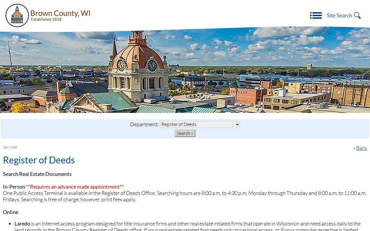
This screen is the handoff from a modern parcel to the recorded chain, not proof that the named owner lived at the property.
Note: Search cost, image cost, and certified-copy cost are separate, even when they concern the same Green Bay deed.
Trace Brown County Past Owners
Begin with the Brown County Property Search or BrownDog parcel map. Record the physical, or situs, address, ParcelID, owner name, legal label, lot or certified survey map reference, and any recent ownership-change date. Keep the tax mailing address separate. It may belong to an owner, trust, or tax contact somewhere else and does not establish occupancy.
- Find the current parcel by street number and confirm its municipality, ParcelID, and legal description.
- Search the current owner as grantee, meaning buyer, and identify the deed by document number, date, and matching legal description.
- Read the grantor, meaning seller, from that deed. Search that party as a grantee in the prior years.
- Repeat the buyer-to-seller handoff. Search spouses, trusts, business names, and spelling variants when an instrument names more than one party.
- At the 1962 cutoff, continue through the appointment-only office terminal, tract index, deed books, microfilm, or archives.
- Grantor and grantee
- The grantor transfers an interest; the grantee receives it. In a purchase deed, those roles usually mean seller and buyer.
- Chain of title
- The linked series of recorded transfers for the same land.
- Legal description
- The lot, block, subdivision, survey, or other land description that stays useful when a street number changes.
- Criss-cross directory
- A directory arranged by street and house number, so an address leads to a listed occupant.
A deed is only one link. A mortgage names a borrower and lender but does not by itself transfer ownership. A release ends a lien. A lis pendens gives notice of pending litigation, while a plat or certified survey map may change parcel geometry. Match the document type and legal description before adding any name to an address history.
Green Bay House History Help
The UWGB House and Building History guide supplies a local research sequence built around deeds, directories, government minutes, histories, business records, and court documents. The Area Research Center holds Brown County land, tax, court, probate, citizenship, school, and municipal material as well as maps and local vertical files. Its partial online name index is useful, but it is not a scan of every file.
A request can include the property owner, county, city or town, year span, section, parcel, lot, and block. The ARC charges $10 for retrieval and up to 20 pages, then 50 cents for each extra page; notarization adds $5. The estimated wait is six to eight weeks. In-person research or a focused request is the practical fallback when a Green Bay previous-residents search reaches material that has never been digitized.
The UWGB guide shown here sets out the evidence layers for a house rather than promising one master resident list. Visit the official house-history guide to check current access details.
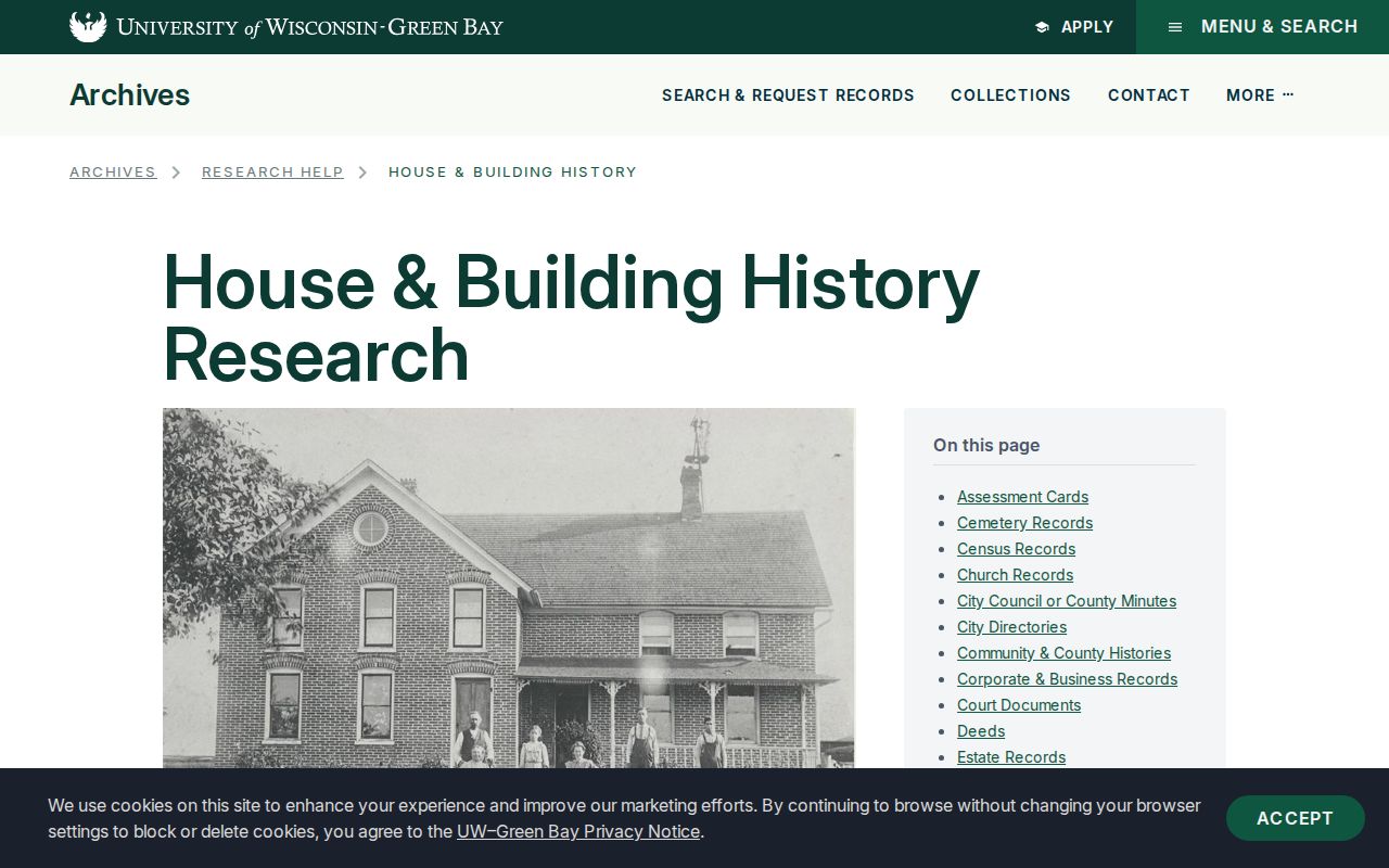
Its method helps separate building history, legal ownership, and the people who occupied the same address.
Map Earlier Green Bay Homes
Sanborn fire-insurance maps date a building’s footprint, number of stories, construction material, use, fire walls, and some business labels. Brown County Library and UWGB hold Green Bay and De Pere maps from the 1880s through the 1960s. The Library of Congress Sanborn collection offers another city-and-date search route. A mapped structure proves that a building existed in that form, not who owned or occupied it.
Plat maps provide the broader land link. Local holdings include an 1875 wall map and maps from 1889, 1900, 1928, and 1936. For an early property, an owner name, subdivision, or public-land-survey section may work when the modern street number does not. Green Bay permit and inspection records can then add a project date, parcel, owner, contractor, and work scope. Older permit coverage was not established in the public research, so ask the city for the file instead of assuming it is online.
Note: BrownDog’s LegalLabel may describe the document that shaped the parcel; use the related DocID to seek the latest recorded instrument.
Green Bay Names Shifted
Place names can break a sound search. Green Bay developed from Navarino and Astor east of the Fox River and Fort Howard to the west. Fort Howard joined the city in 1895, and the Town of Preble consolidated with Green Bay in 1964. An older directory, plat, or municipal record may therefore file the same general area under a former community or jurisdiction.
No verified citywide street-renumbering year was found. Do not turn a failed modern-address search into proof that nobody lived there. Compare street labels in directory prefaces, historic plats, Sanborn sheets, the city’s historic survey, and City Clerk or Planning records. Parcel splits, mergers, condominium stacks, gaps, and overlaps can also change the relationship between one tax polygon and one legal lot.
Green Bay Past Household Trail
Ownership is not occupancy. The Brown County Library has Green Bay and Brown County directories, some dating from the 1870s, plus more than 10,000 print volumes and 4,400 microfilm reels. In a reverse or address section, locate the house number and write down each named occupant, unit, business, and notation. Then check those names in the alphabetical section. The full shelf and entry method belongs on the Green Bay city directory page.
Pair each directory observation with the nearest federal census: 1900, 1910, 1920, 1930, 1940, or the now-public 1950 schedule. Census entries capture a household on one date rather than every occupant during a decade. A missing directory line is also not proof of absence, because publication could be irregular and rural addresses, units, or changed streets might be omitted.
- Copy the address exactly as printed in each available directory year.
- List occupants, spelling variants, units, occupations, spouse or widow notes, and any business entry.
- Compare the closest public census household and note any move, birth, death, or relationship change.
- Check local newspapers, cemetery surname cards, vital indexes, probate files, and the next directory year.
Brown County newspapers on microfilm reach as early as 1833. Gazette titles run digitally from 1870 to 1915, and the Press-Gazette continues from 1915. Obituaries may identify relatives and former communities; probate may show heirs, an executor, and property disposition. The library’s Press-Gazette card files are subject indexes, not complete vital indexes, so search the newspaper run as well.
Lawful use. Research previous residents for house history, family history, estate work, or personal curiosity. Never use an address trail to harass, intimidate, or track a living person.